
Thank you for supporting this site ❤️
Make a donation
Make a donation
Thanöd topographic map
Click on the map to display elevation.
Thank you for supporting this site ❤️
Make a donation
Make a donation
About this map
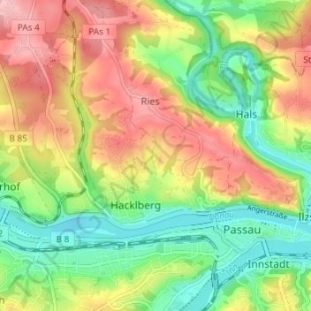
Name: Thanöd topographic map, elevation, terrain.
Location: Thanöd, Passau, Bayern, 94034, Deutschland (48.56432 13.42403 48.60432 13.46403)
Average elevation: 358 m
Minimum elevation: 287 m
Maximum elevation: 443 m
Thank you for supporting this site ❤️
Make a donation
Make a donation