
Thank you for supporting this site ❤️
Make a donation
Make a donation
Geeneinde topographic map
Click on the map to display elevation.
Thank you for supporting this site ❤️
Make a donation
Make a donation
About this map
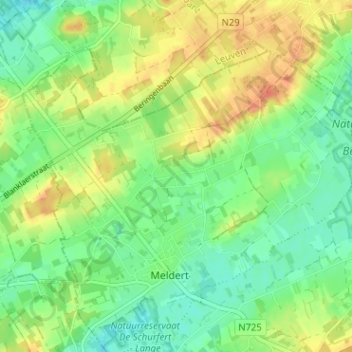
Name: Geeneinde topographic map, elevation, terrain.
Location: Geeneinde, Meldert, Lummen, Hasselt, Limburg, 3560, België (50.98993 5.12310 51.02993 5.16310)
Average elevation: 34 m
Minimum elevation: 15 m
Maximum elevation: 58 m
Thank you for supporting this site ❤️
Make a donation
Make a donation