
Proctor topographic map
Interactive map
Click on the map to display elevation.
About this map
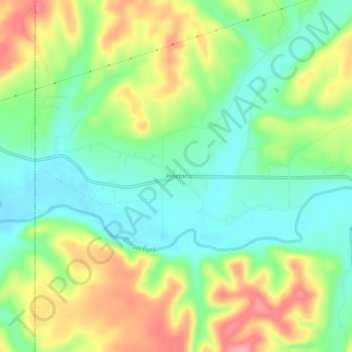
Name: Proctor topographic map, elevation, terrain.
Location: Proctor, Adair County, Oklahoma, United States (35.94620 -94.79745 35.98620 -94.75745)
Average elevation: 272 m
Minimum elevation: 228 m
Maximum elevation: 337 m
Other topographic maps
Click on a map to view its topography, its elevation and its terrain.
Stilwell
United States > Oklahoma > Adair County
Stilwell, Adair County, Oklahoma, 74960, United States
Average elevation: 352 m
Christie
United States > Oklahoma > Adair County
Christie, Adair County, Oklahoma, United States
Average elevation: 283 m
Baron
United States > Oklahoma > Adair County
Baron, Adair County, Oklahoma, United States
Average elevation: 296 m
Cherry Tree
United States > Oklahoma > Adair County
Cherry Tree, Adair County, Oklahoma, United States
Average elevation: 334 m