
رأس منيف topographic map
Interactive map
Click on the map to display elevation.
About this map
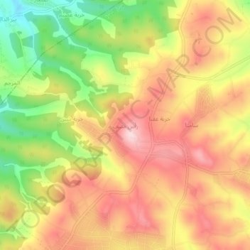
Name: رأس منيف topographic map, elevation, terrain.
Average elevation: 1,071 m
Minimum elevation: 914 m
Maximum elevation: 1,190 m
Other topographic maps
Click on a map to view its topography, its elevation and its terrain.
سامتا
Jordan > Ajlun > Sakhrah Sub-District
سامتا, Sakhrah Sub-District, Ajloun Qasabah District, Ajlun, Jordan
Average elevation: 1,083 m
Sakhra
Jordan > Ajlun > Sakhrah Sub-District
Sakhra, Sakhrah Sub-District, Ajloun Qasabah District, Ajlun, Jordan
Average elevation: 1,042 m