
Thank you for supporting this site ❤️
Make a donation
Make a donation
Littleton topographic map
Click on the map to display elevation.
Thank you for supporting this site ❤️
Make a donation
Make a donation
About this map
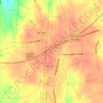
Name: Littleton topographic map, elevation, terrain.
Location: Littleton, Halifax County, North Carolina, United States (36.42457 -77.92008 36.44284 -77.90200)
Average elevation: 111 m
Minimum elevation: 73 m
Maximum elevation: 122 m
Thank you for supporting this site ❤️
Make a donation
Make a donation
Other topographic maps
Click on a map to view its topography, its elevation and its terrain.