
Neuengeseke topographic map
Interactive map
Click on the map to display elevation.
About this map
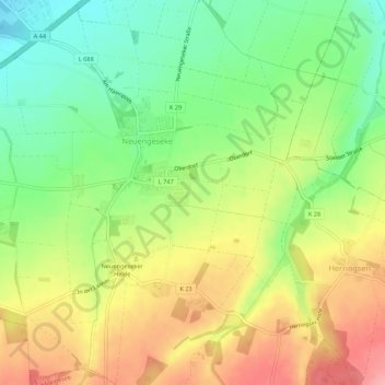
Name: Neuengeseke topographic map, elevation, terrain.
Average elevation: 177 m
Minimum elevation: 126 m
Maximum elevation: 235 m
Other topographic maps
Click on a map to view its topography, its elevation and its terrain.
Lohne
Deutschland > Nordrhein-Westfalen > Kreis Soest > Bad Sassendorf
Lohne, Bad Sassendorf, Kreis Soest, Nordrhein-Westfalen, 59505, Deutschland
Average elevation: 110 m