
Kasendorf topographic map
Interactive map
Click on the map to display elevation.
About this map
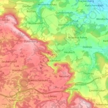
Name: Kasendorf topographic map, elevation, terrain.
Average elevation: 425 m
Minimum elevation: 292 m
Maximum elevation: 560 m
Other topographic maps
Click on a map to view its topography, its elevation and its terrain.
Thurnau
Deutschland > Bayern > Landkreis Kulmbach
Thurnau, Landkreis Kulmbach, Bayern, 95349, Deutschland
Average elevation: 433 m
Marktleugast
Deutschland > Bayern > Landkreis Kulmbach
Marktleugast, Marktleugast (VGem), Landkreis Kulmbach, Bayern, Deutschland
Average elevation: 561 m