
Wittberg topographic map
Interactive map
Click on the map to display elevation.
About this map
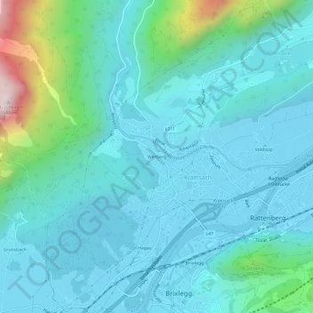
Name: Wittberg topographic map, elevation, terrain.
Location: Wittberg, Kramsach, Bezirk Kufstein, Tirol, 6233, Österreich (47.42770 11.85308 47.46770 11.89308)
Average elevation: 668 m
Minimum elevation: 509 m
Maximum elevation: 1,529 m
Other topographic maps
Click on a map to view its topography, its elevation and its terrain.
Berglsteiner See
Österreich > Tirol > Kramsach
Berglsteiner See, L211, Kramsach, Kufstein, Tirol, 6233, Österreich
Average elevation: 827 m