
Thank you for supporting this site ❤️
Make a donation
Make a donation
Kapellen topographic map
Click on the map to display elevation.
Thank you for supporting this site ❤️
Make a donation
Make a donation
About this map
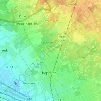
Name: Kapellen topographic map, elevation, terrain.
Location: Kapellen, Anvers, Flandre, 2950, Belgique (51.29265 4.39172 51.36442 4.51900)
Average elevation: 11 m
Minimum elevation: -3 m
Maximum elevation: 27 m
Thank you for supporting this site ❤️
Make a donation
Make a donation