
Cité Louis Piérard topographic map
Interactive map
Click on the map to display elevation.
About this map
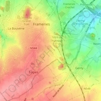
Name: Cité Louis Piérard topographic map, elevation, terrain.
Location: Cité Louis Piérard, Hainaut, Wallonie, 7080, Belgique (50.37920 3.87899 50.41920 3.91899)
Average elevation: 102 m
Minimum elevation: 50 m
Maximum elevation: 143 m