
Labaume topographic map
Interactive map
Click on the map to display elevation.
About this map
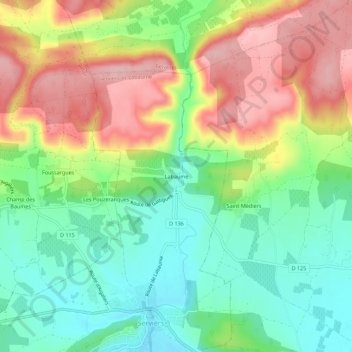
Name: Labaume topographic map, elevation, terrain.
Average elevation: 176 m
Minimum elevation: 104 m
Maximum elevation: 272 m
Other topographic maps
Click on a map to view its topography, its elevation and its terrain.
Serviers
France > Occitanie > Gard > Serviers-et-Labaume
Serviers, Serviers-et-Labaume, Nîmes, Gard, Occitanie, France métropolitaine, 30700, France
Average elevation: 133 m