
Veerampattinam topographic map
Interactive map
Click on the map to display elevation.
About this map
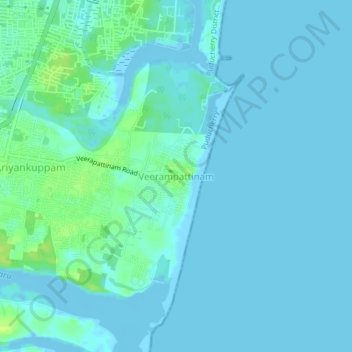
Name: Veerampattinam topographic map, elevation, terrain.
Average elevation: 3 m
Minimum elevation: -5 m
Maximum elevation: 17 m
Other topographic maps
Click on a map to view its topography, its elevation and its terrain.
Puducherry
India > Puducherry > Puducherry Taluk
Puducherry, Puducherry Taluk, Puducherry District, Puducherry, 605001, India
Average elevation: 10 m