
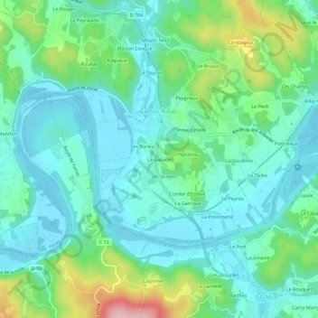
La Gazaille topographic map
Interactive map
Click on the map to display elevation.
About this map
Name: La Gazaille topographic map, elevation, terrain.
Average elevation: 121 m
Minimum elevation: 70 m
Maximum elevation: 280 m
Other topographic maps
Click on a map to view its topography, its elevation and its terrain.
Aillac
France > Nouvelle-Aquitaine > Dordogne > Carsac-Aillac
Aillac, Carsac-Aillac, Sarlat-la-Canéda, Dordogne, Nouvelle-Aquitaine, France métropolitaine, 24200, France
Average elevation: 125 m
Les Bories
France > Nouvelle-Aquitaine > Dordogne > Carsac-Aillac
Les Bories, Carsac-Aillac, Sarlat-la-Canéda, Dordogne, Nouvelle-Aquitaine, France métropolitaine, 24200, France
Average elevation: 120 m