
Laguna Azul topographic map
Interactive map
Click on the map to display elevation.
About this map
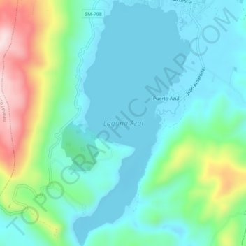
Name: Laguna Azul topographic map, elevation, terrain.
Location: Laguna Azul, Sauce, San Martín, Perú (-6.73493 -76.22811 -6.69216 -76.20761)
Average elevation: 698 m
Minimum elevation: 601 m
Maximum elevation: 1,002 m
Other topographic maps
Click on a map to view its topography, its elevation and its terrain.
Planta de Agua mal construida
Perú > San Martín > Sauce
Planta de Agua mal construida, Sauce, San Martín, Perú
Average elevation: 652 m