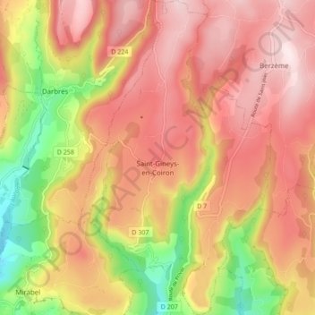
Saint-Gineys-en-Coiron topographic map
Interactive map
Click on the map to display elevation.
About this map
Name: Saint-Gineys-en-Coiron topographic map, elevation, terrain.
Average elevation: 599 m
Minimum elevation: 314 m
Maximum elevation: 793 m

Click on the map to display elevation.
Name: Saint-Gineys-en-Coiron topographic map, elevation, terrain.
Average elevation: 599 m
Minimum elevation: 314 m
Maximum elevation: 793 m