
Reşitpaşa Mahallesi topographic map
Interactive map
Click on the map to display elevation.
About this map
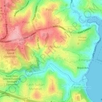
Name: Reşitpaşa Mahallesi topographic map, elevation, terrain.
Location: Reşitpaşa Mahallesi, Sarıyer, Istanbul, Marmara Region, Turkey (41.09866 29.01445 41.11245 29.05174)
Average elevation: 65 m
Minimum elevation: -1 m
Maximum elevation: 143 m
Other topographic maps
Click on a map to view its topography, its elevation and its terrain.
İstinye Mahallesi
İstinye Mahallesi, Sarıyer, Istanbul, Marmara Region, Turkey
Average elevation: 46 m
Ayazağa Mahallesi
Ayazağa Mahallesi, Sarıyer, Istanbul, Marmara Region, Turkey
Average elevation: 93 m