
Bluffton topographic map
Interactive map
Click on the map to display elevation.
About this map
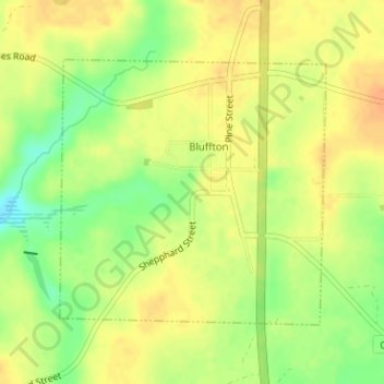
Name: Bluffton topographic map, elevation, terrain.
Location: Bluffton, Clay County, Georgia, 31724, United States (31.51041 -84.88000 31.52907 -84.85802)
Average elevation: 97 m
Minimum elevation: 74 m
Maximum elevation: 110 m
Other topographic maps
Click on a map to view its topography, its elevation and its terrain.
Fort Gaines
United States > Georgia > Clay County
Fort Gaines, Clay County, Georgia, United States
Average elevation: 71 m