
Drabla topographic map
Interactive map
Click on the map to display elevation.
About this map
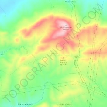
Name: Drabla topographic map, elevation, terrain.
Location: Drabla, El Ouricia, Daïra Aïn Arnat, Sétif, Algérie (36.25651 5.44130 36.29651 5.48130)
Average elevation: 1,247 m
Minimum elevation: 1,111 m
Maximum elevation: 1,418 m
Other topographic maps
Click on a map to view its topography, its elevation and its terrain.
Mahouane
Algérie > Sétif > Daïra Aïn Arnat > El Ouricia
Mahouane, El Ouricia, Daïra Aïn Arnat, Sétif, 19111, Algérie
Average elevation: 1,193 m