
Cessnock City Council topographic map
Interactive map
Click on the map to display elevation.
About this map
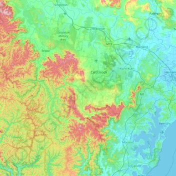
Name: Cessnock City Council topographic map, elevation, terrain.
Location: Cessnock City Council, New South Wales, Australia (-33.13905 150.80129 -32.64888 151.62356)
Average elevation: 140 m
Minimum elevation: -2 m
Maximum elevation: 626 m
Other topographic maps
Click on a map to view its topography, its elevation and its terrain.