
Thank you for supporting this site ❤️
Make a donation
Make a donation
Sindhuli topographic map
Click on the map to display elevation.
Thank you for supporting this site ❤️
Make a donation
Make a donation
About this map
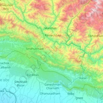
Name: Sindhuli topographic map, elevation, terrain.
Location: Sindhuli, Bagmati Pradesh, Nepal (26.91907 85.41789 27.45134 86.38970)
Average elevation: 912 m
Minimum elevation: 71 m
Maximum elevation: 4,223 m
Thank you for supporting this site ❤️
Make a donation
Make a donation