
湖北大学 topographic map
Interactive map
Click on the map to display elevation.
About this map
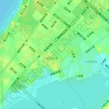
Name: 湖北大学 topographic map, elevation, terrain.
Location: 湖北大学, 徐家棚街道, 武昌区, 武汉市, 湖北省, 430062, 中国 (30.57016 114.31793 30.59016 114.33793)
Average elevation: 23 m
Minimum elevation: 15 m
Maximum elevation: 33 m
Other topographic maps
Click on a map to view its topography, its elevation and its terrain.