
Lac Doré topographic map
Interactive map
Click on the map to display elevation.
About this map
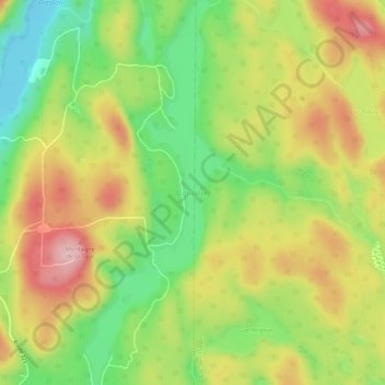
Name: Lac Doré topographic map, elevation, terrain.
Location: Lac Doré, Duhamel, Papineau, Outaouais, Québec, Canada (45.99679 -75.03991 46.03456 -75.02057)
Average elevation: 295 m
Minimum elevation: 203 m
Maximum elevation: 393 m
Other topographic maps
Click on a map to view its topography, its elevation and its terrain.
Lac Gagnon
Canada > Québec > Papineau > Duhamel
Lac Gagnon, Duhamel, Papineau, Outaouais, Québec, Canada
Average elevation: 267 m
Petit lac Preston
Canada > Québec > Papineau > Duhamel
Petit lac Preston, Duhamel, Papineau, Outaouais, Québec, Canada
Average elevation: 264 m
Lac Saint-Ange
Canada > Québec > Papineau > Duhamel
Lac Saint-Ange, Duhamel, Papineau, Outaouais, Québec, Canada
Average elevation: 278 m