
Kampung Chincang topographic map
Interactive map
Click on the map to display elevation.
About this map
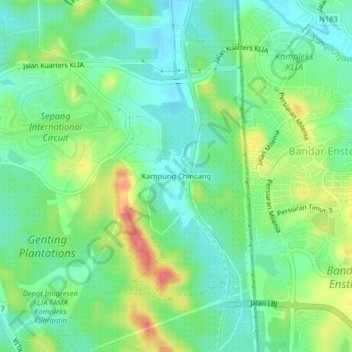
Name: Kampung Chincang topographic map, elevation, terrain.
Location: Kampung Chincang, Selangor, 71760, Malaysia (2.73459 101.73064 2.77459 101.77064)
Average elevation: 36 m
Minimum elevation: 9 m
Maximum elevation: 86 m