
Weillen topographic map
Interactive map
Click on the map to display elevation.
About this map
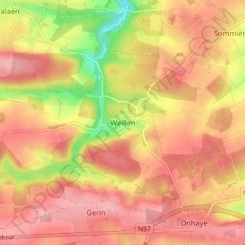
Name: Weillen topographic map, elevation, terrain.
Location: Weillen, Onhaye, Dinant, Namur, Wallonie, 5523, Belgique (50.23991 4.80269 50.27991 4.84269)
Average elevation: 226 m
Minimum elevation: 145 m
Maximum elevation: 269 m