
La Plum topographic map
Interactive map
Click on the map to display elevation.
About this map
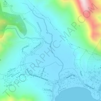
Name: La Plum topographic map, elevation, terrain.
Location: La Plum, Mont Dore, Province Sud, Nouvelle-Calédonie (-22.27572 166.61588 -22.25316 166.62551)
Average elevation: 89 m
Minimum elevation: 0 m
Maximum elevation: 477 m