
Thank you for supporting this site ❤️
Make a donation
Make a donation
Lac Jourdain topographic map
Click on the map to display elevation.
Thank you for supporting this site ❤️
Make a donation
Make a donation
About this map
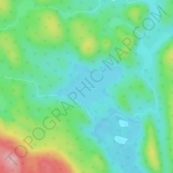
Name: Lac Jourdain topographic map, elevation, terrain.
Average elevation: 434 m
Minimum elevation: 384 m
Maximum elevation: 558 m
Thank you for supporting this site ❤️
Make a donation
Make a donation
Other topographic maps
Click on a map to view its topography, its elevation and its terrain.
Galerie d'amenée d'eau, Manic-5
Canada > Québec > Manicouagan > Rivière-aux-Outardes
Average elevation: 339 m
Thank you for supporting this site ❤️
Make a donation
Make a donation
Thank you for supporting this site ❤️
Make a donation
Make a donation
Thank you for supporting this site ❤️
Make a donation
Make a donation