
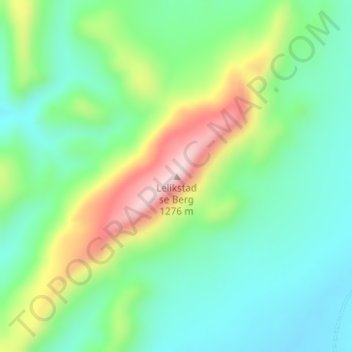
Lelikstad se Berg topographic map
Interactive map
Click on the map to display elevation.
About this map
Name: Lelikstad se Berg topographic map, elevation, terrain.
Average elevation: 1,067 m
Minimum elevation: 964 m
Maximum elevation: 1,280 m
Other topographic maps
Click on a map to view its topography, its elevation and its terrain.
Douglas
South Africa > Northern Cape > Pixley ka Seme District Municipality > Siyancuma Local Municipality > Douglas
Douglas, Siyancuma Local Municipality, Pixley ka Seme District Municipality, Northern Cape, 8730, South Africa
Average elevation: 1,010 m