
Cerro Yeguas Heladas Norte topographic map
Interactive map
Click on the map to display elevation.
About this map
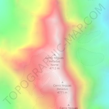
Name: Cerro Yeguas Heladas Norte topographic map, elevation, terrain.
Average elevation: 4,059 m
Minimum elevation: 3,280 m
Maximum elevation: 4,769 m
Other topographic maps
Click on a map to view its topography, its elevation and its terrain.
Portillo
Chile > Región de Valparaíso > Provincia de Los Andes > Los Andes > Portillo
Portillo, Los Andes, Provincia de Los Andes, Región de Valparaíso, Chile
Average elevation: 3,196 m