
Muleshoe topographic map
Interactive map
Click on the map to display elevation.
About this map
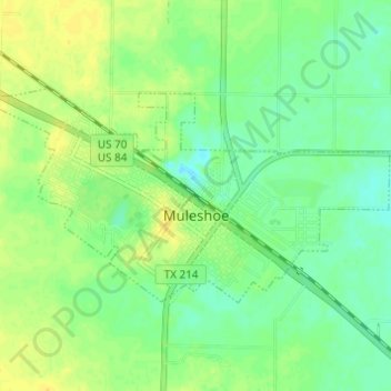
Name: Muleshoe topographic map, elevation, terrain.
Location: Muleshoe, Bailey County, Texas, 79347, United States (34.21552 -102.75853 34.24330 -102.69750)
Average elevation: 1,158 m
Minimum elevation: 1,147 m
Maximum elevation: 1,168 m
Muleshoe is situated on the Great Plains in an area where the plains reach their highest altitude at the foot of the Rocky Mountains known as the High Plains; more specifically, it is located on the South Plains in a region known as the Llano Estacado. The area topology is gently rolling plains with a large number of playa lakes on top of a large plateau. Soil types vary from dark brown playa-lake silt to iron-rich clay to sandy soil; topsoil and subsoil layers vary, as well. Most of the area contains a layer of caliche; in some areas, no topsoil or subsoil reveals the layer of caliche, while other places have up to 4 ft of topsoil or subsoil combined.