
涟源市 topographic map
Interactive map
Click on the map to display elevation.
About this map
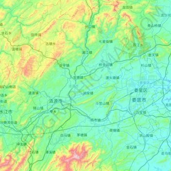
Name: 涟源市 topographic map, elevation, terrain.
Location: 涟源市, 娄底市, 湖南省, 中国 (27.44851 111.55478 28.04576 112.02941)
Average elevation: 330 m
Minimum elevation: 86 m
Maximum elevation: 1,492 m
涟源地处雪峰山东南麓,全市地形多为丘陵和山地,年平均气温16℃,降水量1328毫米。农业主产水稻、甘薯、柑橘、茶叶和猪、鸡、牛、羊畜养等。
Other topographic maps
Click on a map to view its topography, its elevation and its terrain.