
Robbins Park topographic map
Interactive map
Click on the map to display elevation.
About this map
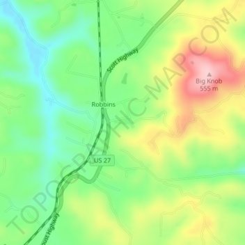
Name: Robbins Park topographic map, elevation, terrain.
Average elevation: 438 m
Minimum elevation: 359 m
Maximum elevation: 551 m
Other topographic maps
Click on a map to view its topography, its elevation and its terrain.
Robbins
United States > Tennessee > Scott County > Robbins
Robbins, Scott County, Tennessee, 37852, United States
Average elevation: 436 m