
Thank you for supporting this site ❤️
Make a donation
Make a donation
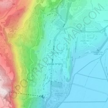
Kiryat Shmona topographic map
Click on the map to display elevation.
Thank you for supporting this site ❤️
Make a donation
Make a donation
Kiryat Shmona
Kiryat Shmona is located in the Finger of the Galilee next to Hula Valley, about 5 kilometres (3 miles) south and 2 km (1 mile) east of the Israel–Lebanon border. Its elevation is about 150 metres (492 feet) above sea level.
Thank you for supporting this site ❤️
Make a donation
Make a donation
About this map
Name: Kiryat Shmona topographic map, elevation, terrain.
Location: Kiryat Shmona, Safed Subdistrict, North District, Israel (33.19070 35.54959 33.23246 35.60341)
Average elevation: 283 m
Minimum elevation: 72 m
Maximum elevation: 877 m
Thank you for supporting this site ❤️
Make a donation
Make a donation
Other topographic maps
Click on a map to view its topography, its elevation and its terrain.