
Baie de La Forêt topographic map
Interactive map
Click on the map to display elevation.
About this map
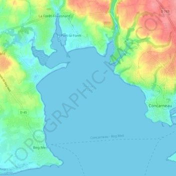
Name: Baie de La Forêt topographic map, elevation, terrain.
Average elevation: 18 m
Minimum elevation: -1 m
Maximum elevation: 81 m
Other topographic maps
Click on a map to view its topography, its elevation and its terrain.
La Grande Halte
France > Bretagne > La Forêt-Fouesnant
La Grande Halte, La Forêt-Fouesnant, Quimper, Finistère, Bretagne, France métropolitaine, 29940, France
Average elevation: 62 m