
Lac Vert topographic map
Interactive map
Click on the map to display elevation.
About this map
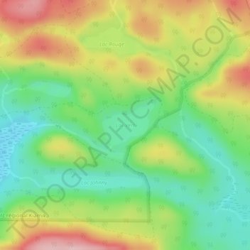
Name: Lac Vert topographic map, elevation, terrain.
Average elevation: 348 m
Minimum elevation: 266 m
Maximum elevation: 459 m
Other topographic maps
Click on a map to view its topography, its elevation and its terrain.
Lac Malo
Canada > Québec > Antoine-Labelle > Rivière-Rouge
Lac Malo, Rivière-Rouge, Antoine-Labelle, Laurentides, Québec, Canada
Average elevation: 287 m
Marchand
Canada > Québec > Antoine-Labelle > Rivière-Rouge
Marchand, Rivière-Rouge, Antoine-Labelle, Laurentides, Québec, J0T 1T0, Canada
Average elevation: 269 m
Lac Lacoste
Canada > Québec > Antoine-Labelle > Rivière-Rouge
Lac Lacoste, Rivière-Rouge, Antoine-Labelle, Laurentides, Québec, Canada
Average elevation: 299 m