
Sefiane topographic map
Interactive map
Click on the map to display elevation.
About this map
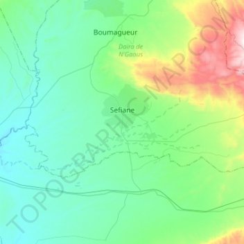
Name: Sefiane topographic map, elevation, terrain.
Location: Sefiane, Daïra N'Gaous, Batna, 05064, Algérie (35.37865 5.45658 35.47620 5.71504)
Average elevation: 722 m
Minimum elevation: 505 m
Maximum elevation: 1,551 m
Other topographic maps
Click on a map to view its topography, its elevation and its terrain.