
Lac Campeau topographic map
Interactive map
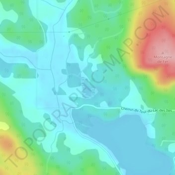
Click on the map to display elevation.
About this map
Name: Lac Campeau topographic map, elevation, terrain.
Average elevation: 242 m
Minimum elevation: 204 m
Maximum elevation: 364 m
Other topographic maps
Click on a map to view its topography, its elevation and its terrain.
Lac Charlebois
Canada > Québec > Antoine-Labelle > Mont-Laurier
Lac Charlebois, Mont-Laurier, Antoine-Labelle, Laurentides, Québec, Canada
Average elevation: 270 m
Lac Pope
Canada > Québec > Antoine-Labelle > Mont-Laurier
Lac Pope, Mont-Laurier, Antoine-Labelle, Laurentides, Québec, Canada
Average elevation: 280 m