
Aşkale topographic map
Interactive map
Click on the map to display elevation.
About this map
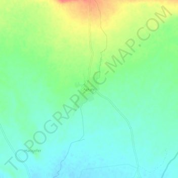
Name: Aşkale topographic map, elevation, terrain.
Location: Aşkale, Ağrı merkez, Ağrı, Eastern Anatolia Region, Turkey (39.77542 43.01534 39.81542 43.05534)
Average elevation: 1,671 m
Minimum elevation: 1,653 m
Maximum elevation: 1,704 m