
Burgruine Waldenfels topographic map
Interactive map
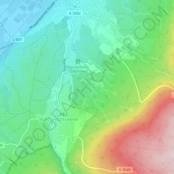
Click on the map to display elevation.
About this map
Name: Burgruine Waldenfels topographic map, elevation, terrain.
Average elevation: 236 m
Minimum elevation: 117 m
Maximum elevation: 475 m
Other topographic maps
Click on a map to view its topography, its elevation and its terrain.
Waldprechtsweier
Deutschland > Baden-Württemberg > Malsch > Waldprechtsweier
Waldprechtsweier, Malsch, Landkreis Karlsruhe, Baden-Württemberg, 76316, Deutschland
Average elevation: 246 m