
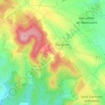
Mont Bénard topographic map
Interactive map
Click on the map to display elevation.
About this map
Name: Mont Bénard topographic map, elevation, terrain.
Average elevation: 156 m
Minimum elevation: 92 m
Maximum elevation: 242 m
Other topographic maps
Click on a map to view its topography, its elevation and its terrain.
Courcelles
France > Hauts-de-France > Oise > Savignies > Courcelles
Courcelles, Savignies, Beauvais, Oise, Hauts-de-France, France métropolitaine, 60650, France
Average elevation: 165 m