
Thank you for supporting this site ❤️
Make a donation
Make a donation
Kottakkani topographic map
Click on the map to display elevation.
Thank you for supporting this site ❤️
Make a donation
Make a donation
About this map
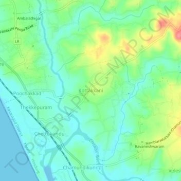
Name: Kottakkani topographic map, elevation, terrain.
Location: Kottakkani, Hosdurg, Kasaragod District, Kerala, 671316, India (12.35926 75.04585 12.39926 75.08585)
Average elevation: 23 m
Minimum elevation: -4 m
Maximum elevation: 77 m
Thank you for supporting this site ❤️
Make a donation
Make a donation
Other topographic maps
Click on a map to view its topography, its elevation and its terrain.