
Hammam Rabi topographic map
Interactive map
Click on the map to display elevation.
About this map
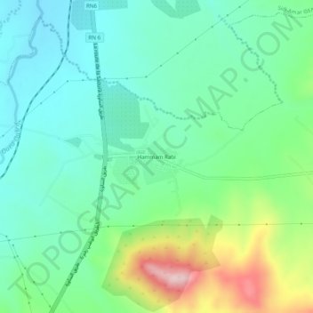
Name: Hammam Rabi topographic map, elevation, terrain.
Location: Hammam Rabi, Ouled Khaled, Daïra Sidi Boubekeur, Saïda, Algérie (34.91239 0.16148 34.95239 0.20148)
Average elevation: 720 m
Minimum elevation: 641 m
Maximum elevation: 923 m