
Wood Lanes topographic map
Interactive map
Click on the map to display elevation.
About this map
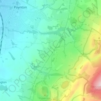
Name: Wood Lanes topographic map, elevation, terrain.
Average elevation: 162 m
Minimum elevation: 89 m
Maximum elevation: 375 m
Other topographic maps
Click on a map to view its topography, its elevation and its terrain.
Higher Poynton
United Kingdom > England > Cheshire East > Poynton > Higher Poynton
Higher Poynton, Poynton-with-Worth, Poynton, Cheshire East, England, SK12 1TJ, United Kingdom
Average elevation: 157 m