
Westfield topographic map
Interactive map
Click on the map to display elevation.
About this map
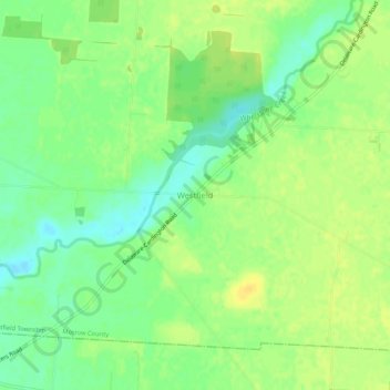
Name: Westfield topographic map, elevation, terrain.
Average elevation: 295 m
Minimum elevation: 282 m
Maximum elevation: 305 m
Other topographic maps
Click on a map to view its topography, its elevation and its terrain.
Russell
United States > Ohio > Morrow County
Russell, Gilead Township, Morrow County, Ohio, 43315, United States
Average elevation: 341 m
Cardington
United States > Ohio > Morrow County
Cardington, Cardington Township, Morrow County, Ohio, United States
Average elevation: 310 m
Marengo
United States > Ohio > Morrow County
Marengo, Bennington Township, Morrow County, Ohio, United States
Average elevation: 345 m
Mount Gilead
United States > Ohio > Morrow County
Mount Gilead, Gilead Township, Morrow County, Ohio, 43338, United States
Average elevation: 346 m