
Thank you for supporting this site ❤️
Make a donation
Make a donation
Le Plateau topographic map
Click on the map to display elevation.
Thank you for supporting this site ❤️
Make a donation
Make a donation
About this map
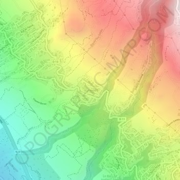
Name: Le Plateau topographic map, elevation, terrain.
Location: Le Plateau, Saint-Leu, Saint-Paul, La Réunion, France (-21.22880 55.32261 -21.22406 55.32754)
Average elevation: 343 m
Minimum elevation: 7 m
Maximum elevation: 685 m
Thank you for supporting this site ❤️
Make a donation
Make a donation
Other topographic maps
Click on a map to view its topography, its elevation and its terrain.
Thank you for supporting this site ❤️
Make a donation
Make a donation
Thank you for supporting this site ❤️
Make a donation
Make a donation
Thank you for supporting this site ❤️
Make a donation
Make a donation