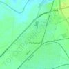
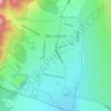
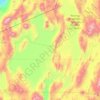
Mollar topographic map
Click on the map to display elevation.
About this map

Name: Mollar topographic map, elevation, terrain.
Average elevation: 1,075 m
Minimum elevation: 965 m
Maximum elevation: 1,304 m
Other topographic maps
Click on a map to view its topography, its elevation and its terrain.
Salta
Salta has a subtropical highland climate (Cwb, according to the Köppen climate classification), and it is characterized by pleasant weather year-round. Located in the subtropical north, but at an altitude of 1,200 metres, Salta enjoys 4 distinct seasons: summers are warm with frequent thunderstorms, with…
Average elevation: 1,270 m

Municipio de San Antonio de los Cobres
The town is known for its high elevation of approximately 3,775 meters (12,385 feet) above sea level, being one of the highest elevations of any city or town in Argentina. It is located approximately 160 kilometers (99 mi) from the city of Salta and 2,000 kilometers (1,200 mi) from the capital, Buenos Aires.…
Average elevation: 3,733 m


Municipio Iruya
Located in the altiplano region along the Iruya River, Iruya sits nestled against the mountainside at an elevation of 2,780 meters (9,120 feet). It is located over 300 kilometers (190 mi) from the province capital of Salta. There is no direct road connection to the rest of the Salta province and access is…
Average elevation: 3,534 m