
Thank you for supporting this site ❤️
Make a donation
Make a donation
Riuche Knoka topographic map
Click on the map to display elevation.
Thank you for supporting this site ❤️
Make a donation
Make a donation
About this map
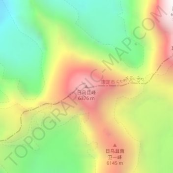
Name: Riuche Knoka topographic map, elevation, terrain.
Location: Riuche Knoka, Kangding, Kardze, Sichuan, 626000, China (29.76259 101.86993 29.76269 101.87003)
Average elevation: 5,576 m
Minimum elevation: 4,849 m
Maximum elevation: 6,474 m
Thank you for supporting this site ❤️
Make a donation
Make a donation
Other topographic maps
Click on a map to view its topography, its elevation and its terrain.