
Colón topographic map
Interactive map
Click on the map to display elevation.
About this map
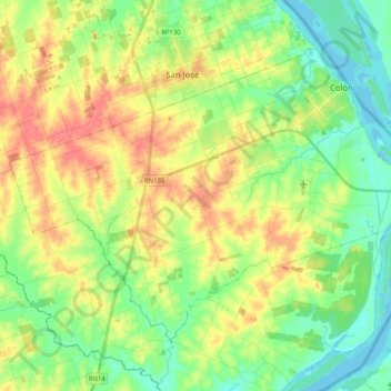
Name: Colón topographic map, elevation, terrain.
Average elevation: 21 m
Minimum elevation: -1 m
Maximum elevation: 63 m
Other topographic maps
Click on a map to view its topography, its elevation and its terrain.
Colonia Hughes
Argentina > Entre Ríos > Distrito Primero > Colón > Colonia Hughes
Colonia Hughes, Colón, Distrito Primero, Departamento Colón, Entre Ríos, Argentina
Average elevation: 24 m