
Семенково topographic map
Interactive map
Click on the map to display elevation.
About this map
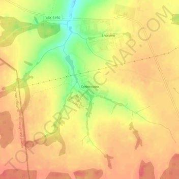
Name: Семенково topographic map, elevation, terrain.
Average elevation: 212 m
Minimum elevation: 174 m
Maximum elevation: 229 m
Other topographic maps
Click on a map to view its topography, its elevation and its terrain.
Семенково
Россия > Московская область > городской округ Кашира > Семенково
Семенково, городской округ Кашира, Московская область, Центральный федеральный округ, Россия
Average elevation: 212 m