
Küçük Ayasofya Mahallesi topographic map
Interactive map
Click on the map to display elevation.
About this map
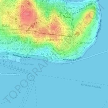
Name: Küçük Ayasofya Mahallesi topographic map, elevation, terrain.
Average elevation: 16 m
Minimum elevation: -1 m
Maximum elevation: 71 m
Other topographic maps
Click on a map to view its topography, its elevation and its terrain.
Yedikule Mahallesi
Yedikule Mahallesi, Istanbul, Fatih, Istanbul, Marmara Region, Turkey
Average elevation: 15 m
Yavuz Sultan Selim Mahallesi
Yavuz Sultan Selim Mahallesi, Istanbul, Fatih, Istanbul, Marmara Region, Turkey
Average elevation: 28 m