
El Estanco topographic map
Interactive map
Click on the map to display elevation.
About this map
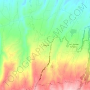
Name: El Estanco topographic map, elevation, terrain.
Location: El Estanco, Almoloya de Juárez, Estado de México, México (19.30630 -99.90503 19.34630 -99.86503)
Average elevation: 2,852 m
Minimum elevation: 2,735 m
Maximum elevation: 3,002 m
Other topographic maps
Click on a map to view its topography, its elevation and its terrain.
San Antonio Buenavista
México > Estado de México > Almoloya de Juárez > San Antonio Buenavista
San Antonio Buenavista, Almoloya de Juárez, Estado de México, México
Average elevation: 2,741 m